
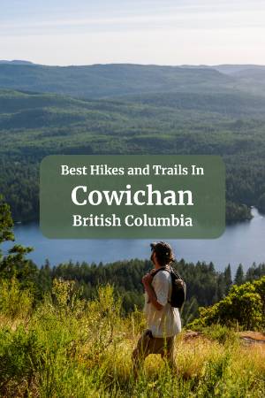
Old Baldy Mountain

My personal favourite in the whole region. It's just challenging enough to get your heart rate up without wrecking your legs for the next two days. The views from the top over Shawnigan Lake are one of my favourite sights in the area, and there's a swing near the summit made from rope and a piece of wood hung over an arbutus tree that is, objectively, a great place to sit and feel a little whimsical.
Be Careful: Do not follow the AllTrails route. We did, and we regretted it.
AllTrails takes you on a counter-clockwise loop that starts by sending you up a wildly steep private road into an equally steep section of trail covered in large rocky scrambles. It gets you to the peak fast, but "fast" here means breathing hard and watching your footing the entire time rather than actually enjoying the climb.
The smarter move is to drive to the small dirt parking lot on the other side of the mountain and hike up via the gradual, well-maintained trail. It's maybe ten minutes slower. The path is wide enough to walk side by side, and the footing is easy the whole way up. So park at this pin, and use Strava, or just an empty AllTrails navigation to follow the trail up to the peak and then turn back and skip the wildly steep section altogether.


If you do it this way, watch for a small trail branching left off the main path a few minutes before the summit. That's where the swing is, at coordinates 48.63314, -123.61396 if you want to pin it ahead of time.
Old Baldy is also a solid sunset hike. The peak faces the right direction, and the timing works well. If you're planning to come down in the dark, bring headlamps.
Since there is no route on AllTrails for the gradual route, I've included this screenshot below to show the route you will want to follow to the peak.

Stoney Hill

One of the best effort-to-reward ratios in Cowichan. It's an easy-to-moderate loop with several viewpoints, and the payoff keeps getting better the further you go.
The trailhead signs mark the first three-quarters of the counter-clockwise route as "easy" and the last quarter as "difficult." Don't let that put you off. The terrain on that last stretch has more roots and some steeper sections, and the path narrows, but the whole trail is manageable, and that final viewpoint is the best one on the loop.
From up there, you're looking out at the narrow channel separating Vancouver Island from Salt Spring Island, and back along the coast at the green spread of the Cowichan Valley below. The forested sections in between are some of the nicest forest trails in the area.
Do this one counter-clockwise and save the best view for last.
Mount Provost

The short version: you can hike it or drive it, and either way you end up at a summit with views of Mount Baker, the Cowichan area, and on a clear day, the towers of downtown Vancouver.
The drive option takes a forest service road almost all the way to the top. The first four-fifths of it are bumpy and uneven but mostly fine, with wide curves and room for two cars to pass. Near the top, there are two steep sections with bigger rocks and some potholes. We had no trouble in a Subaru Forester, but you want decent tires and a bit of clearance. This is not a road you will see an expensive car on.
If you'd rather hike it, the trail is 9.3 km with 685 metres of elevation gain. It starts through beautiful coastal rainforest and is well-marked with flagging. Most of it is not technically demanding, though the last kilometre is fairly steep and there's a roped section near the summit. This is a hike, not a walk. If you're not used to bigger elevation days, the drive option is probably for you.
If you do drive up, you can't drive all the way to the peak. There is a clear dirt parking area, and from here, you are in a kind of natural saddle where the mountain rises on your left and right. To your left, there is a narrow and challenging trail to the actual peak, and to the right, there is a wider, easier trail to a big clearing that paragliders launch from.
Personally, I find the views from the launch point more impressive than from the true peak, and it is a better sunset spot. Use Strava or AllTrails to follow either path from the parking spot.
Kinsol Trestle


I would classify this as more of a walk than a hike, but it’s well worth it.
This is actually a portion of a much longer trail that is popular with cyclists, but this route specifically takes you from the large gravel parking lot to the Kinsol Trestle: a massive wooden trestle bridge that spans across a huge gorge with a river below.
The Kinsol Trestle is one of the largest free-standing wooden railway trestles in the world, and this hike will take you across it, to a great viewing platform of it, then down to the river, where you can look up at it and really get a sense of its scale.
The trail is 3.1 km with 76 metres of elevation gain and takes about an hour. From the side closer to the parking lot, there's an easy close-up viewpoint where you can touch the trestle and look up at the scale of it from below. A small viewing platform juts out to give a better angle. Cross the trestle to the far side, and there's a second viewpoint platform, a covered area with historical plaques about the trestle's past, and a trail leading all the way down to the riverbank where you can look back up at the full structure from below.
The view from the bottom is incredible, but that is where about 75 out of the 76 meters of elevation gain come from. The rest of the trail is quite flat, so if you want to make it a much easier walk, you can just hit up the higher up view points and call it a day.
Outhouses are available at the trailhead parking lot and on the far side of the trestle.
Christie Falls


Who doesn't love a long walk to a cool waterfall? This is a classic BC hike. Logging road, windy forest paths, river crossing across fallen trees, cabin in the middle of nowhere, and a remote hidden waterfall. What more could you ask for?
From the trailhead, the first section is a long, very gradual uphill along a dirt road. Do not drive this road, even if the gate is open when you arrive. There's a hatchery further along that uses the road for access, and the gate opens and closes based entirely on when the hatchery staff leave for the day.
We arrived to a closed gate, had a truck pass us on the way in, and came back to an open gate. If you park inside the gate and it closes while you're on the trail, your car is stuck there until someone decides to open it again. Park outside and walk.
After the dirt road section, the trail turns off onto a narrower, steeper path. There's a drop toilet near the hatchery turnoff if you need it. The terrain gets more rooty and demanding from here, nothing technical, but you're hiking rather than walking at this point. There's one creek crossing on a fallen tree that's been cut flat enough to walk across without much drama. More of a wide bridge than a balance act, and there is a rope strung across if you do need the extra balance.
The falls at the end are worth every step of it. The water isn't falling from a great height, but it cascades across an unusually wide section of exposed rock in a way that looks spectacular. It's a broad, flat pour rather than a single concentrated drop, and it falls into a large pool below. On a hot day, an excellent place to cool down. Not deep enough for diving or real swimming, but deep enough to sit in up to your shoulders and let the cold mountain water cool you off.
The trail continues as a loop on the descent rather than retracing the same path, and I'd recommend going that way. The forest on the other side is different enough to be worth seeing, and the route passes a cabin in the woods that looks like it just appeared out of nowhere.
Stocking Creek Falls


A short, flat walk that ends at a wooden boardwalk and staircase leading to a viewpoint above the falls. Easy to do, photogenic, and a good option if you want a waterfall experience without committing to a full hike.
The viewing area used to allow people to walk out closer to the base of the falls, but that section is now closed off to let the natural environment around it recover. The viewpoint from the boardwalk is still solid. This one works well as a quick stop rather than a destination in its own right.
Heart Lake Trail
A moderately challenging 10.3 km loop with 343 metres of elevation gain, taking roughly three to four hours. The destination is a lake that is naturally heart-shaped when seen from above.
The stone stair section is steep enough that going up is noticeably harder than coming down, so factor that into which direction you do the loop. There are a few waterfalls along the old logging road on the descent, and a solid viewpoint just before the lake that's worth stopping at for a snack before the final push.
The section near the lake has some wet ground, and the trail has stretches of compacted gravel and pine cones that can be a bit slippery underfoot. Trekking poles come in handy here, but aren't strictly necessary.
At roughly 7 km in before you reach the lakes, this one is definitely more for those who actually enjoy the hike in. The lake is pretty, but it's hard to see its full shape from the ground, and with the moderate challenge of the hike, it definitely has a much worse effort-to-reward ratio than Stoney Mountain or Old Baldy Mountain.
Skutz Falls Trail


A 6.9 km loop in Cowichan River Provincial Park that takes about an hour and a half to two hours. The trail follows rushing rapids and passes waterfalls, moves through old-growth forest, and crosses a historic railway trestle that's worth the trip on its own.
Elevation gain is modest at 139 metres, so the focus here is atmosphere rather than effort. This is the one to do on a moody, overcast day when the river is high and the forest is dripping.
Crofton Community Sea Walk

This is not a hike; it's a walk, with coffee in hand, ideally. It runs about 1.4 km along the coast from the Crofton ferry port to Crofton Beach Park, following paths and boardwalks with only 11 metres of elevation gain. The whole thing takes between half an hour and an hour at a relaxed pace.
Go at high tide if you can plan around it. At low tide, the coastline loses some of its appeal and can get a bit fragrant. Along the way, you'll pass a large RV park, almost always populated with a steady rotation of older travellers sitting around fires, drinking wine, and socializing. It has a very specific and pleasant energy.
Still on the List
A few trails I haven't fully explored yet that are worth knowing about:
Chemainus Lake Loop and Mount Tzouhalem Viewpoint Trail are both on my radar. More on those once I've done them properly.
How to Plan Your Day
- If you want a summit with the best views, Old Baldy, via the gradual trail from the small parking lot. Add the swing. Don't rush down.
- If you want the best effort-to-reward ratio, Stoney Hill, counter-clockwise, save the last viewpoint for the end.
- If you want a full elevation day, Mount Provost on foot. Or drive it and spend the extra energy on a second trail.
- If you want something scenic without working hard, Skutz Falls for atmosphere, or the Crofton Sea Walk if you just want to stretch your legs after lunch.
Final Thoughts
I hope this guide will help you understand the hiking options in the area and which trail is right for you. If you only have a few days in Cowichan, I would suggest just picking one or two of the trails that line up best with your interests and then spend the rest of your time exploring the rest of what Cowichan has to offer. I would highly recommend a lake day at Cowican Lake, and maybe a day exploring the towns and the roadside stops as well. You know what they say: variety is the spice of life!
If you’re interested in exploring more of Cowichan, check out our Waterfall Guide, our Lake Day Guide, or our 3-Day Itinerary to help plan a seamless trip.
FAQ
What are the best hikes in the Cowichan Valley?
What is the best easy hike in the Cowichan Valley?
Is Old Baldy Mountain difficult?
Can you drive to the top of Mount Provost?
When is the best time of year to hike in the Cowichan Valley?
Our Trusted Travel Partners
We only recommend products and services we personally use and trust.

SafetyWing
Travel medical insurance for nomads and remote workers
Booking.com
Find the best deals on hotels, apartments, and vacation rentals
AllTrails
Discover hiking trails with detailed maps and reviews
Surfshark
Secure VPN for safe browsing and accessing content worldwide
Get Your Guide
Find the best deals on tours and experiences
Airalo
Prepaid SIM cards for travelers
Trusted Housesitters
Find free accommodation by house and pet sitting worldwide
Wise
Send and receive money internationally with low fees* We may earn a commission when you make a purchase through our affiliate links, at no extra cost to you. We appreciate this support, which helps sustain our blog and allows us to create more content and help more great trips get planned!